Ground Water Exploration
Our Groundwater Services
Groundwater Investigation (GW):
Conducting extensive groundwater surveys, we utilize advanced geophysical methods to comprehend subsurface flow patterns.
Rainwater Harvesting Plan (RW):
Upon identifying groundwater resources, we assist in implementing rainwater harvesting systems to safeguard and replenish these crucial reserves.
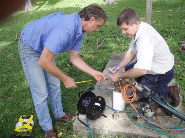
Borewell Camera Scanning (BS):
Employing state-of-the-art bore well camera scanning, we detect and resolve bore well issues, ensuring optimal performance.
Water Quality Testing (WQ):
Ensuring top-notch water quality, our tests conducted in accredited NABL laboratories guarantee the water you utilize meets the highest standards.
Borewell Drilling (BD):
Employing specialized drilling methods tailored to diverse geological formations ensures efficient bore well construction.
Pumping Tests (PT):
Determining bore well yields, motor specifications, and optimal operational hours are pivotal for resource sustainability.
Hydrogeological Assessments (HA):
Conducted to support various purposes like water resource management, environmental impact assessments, groundwater exploration, and land development planning.
Water Audit (WA):
Analyzing water usage and distribution, our water audit identifies inefficiencies, promoting sustainable water management practices.
Groundwater Modelling (GM):
An invaluable tool used to simulate and comprehend groundwater movement within aquifers, predict future behaviors, and assess the impacts of diverse factors on groundwater resources. More Info
Groundwater Investigation by PQWT & 3D
Explore state-of-the-art groundwater investigation technology with our Portable Quick Well Tester (PQWT) and advanced 3D Locator Equipment. Efficiently pinpoint hidden water sources using cutting-edge electrical resistivity surveys.
Optimize your water resource potential. Reach out today for innovative solutions in groundwater exploration and sustainable management
Groundwater Investigation through Hydrogeological and Resistivity Survey Methods
Transform your grasp of groundwater dynamics through our innovative Gradient Resistivity method! By deploying multiple survey lines, we generate intricate subsurface structure maps, offering profound insights into groundwater flow zones. This spatial map, combined with real-time and past hydrogeological data alongside satellite imagery, becomes the cornerstone for swift and informed decision-making. Our streamlined process guarantees a thorough study accomplished within 3 to 4 days, ensuring prompt and precise results. Opt for our expertise in cutting-edge geophysical methods, an integrated approach, and our dedication to unveiling subterranean secrets swiftly and accurately.